|
DIRECTION TO THE HILL:
Take 91 East or West bound freeway to the La Sierra Ave off Ramp and head North.
North On La Sierra Ave. a few miles until you reach Arlington Ave. Here you will make a right hand turn at the light. After making your right turn, move over into the center lane to make a Left at the frist street on your left. This is Western Ave. Take western all the way until it dead ends at the Corona Power fields gate. Make a right on Country Bluff Ave.
Follow this street to were it dead ends at our gate.
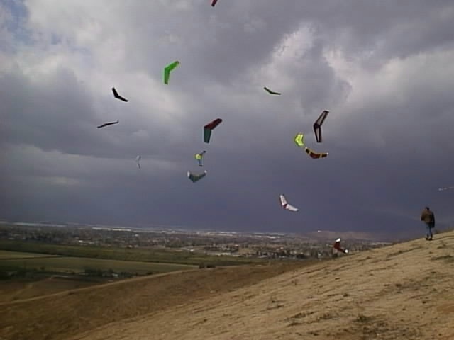
You will see the La Sierra Slope Soarers sign on the left next to the gate. If the gate is open, drive over the curve and head up the hill to the top and park on the back side with the other cars. If the gate is locked just park your car or Truck on the street and walk up to the top.
Other Flying Sites In Southern California
Flying Sites
This is a general listing of the Southern California, U.S.A Flying Sites that the ISR club usually flies.
INLAND SLOPE REBELS (ISR) Club Flying Site, Riverside, CA USA
Take 91 or 60 Fwy East to Riverside, CA. Turn off on Van Buren, go (South From 60, North from 91), then East on Limonite.
Turn left on Camino Real, and left on Live Oak. Take a left on Piasano, and then right on Kachina. Drive straight up onto dirt road, and then another hard right at big fork in dirt road. drive to the top and park. This is a west wind hill, and blows almost every day. There is also a North facing slope, with an olympic size swimming pool. (Actually it is a Reservoir!) The road washes out, and only a four-wheel drive will make it. But you can easily walk up.
CADIAC HILL, Moreno Valley, CA USA
Southeast Moreno Valley, CA. Take hwy 60 to Theodore. Go straight south onto dirt road at Alessandro blvd. intersection. Drive along mountains for 1 1/2 mile. park on access road on right by the barbed wire fence. Look up into the bowl of the mountain on the right. Now comes the fun part - the 1/2 mile hike to the middle of the mountain. Wind barely blows from the south, but lift is excellent! East Wind (Santa Ana) conditions only, mostly morning breezes.
KONG HILL, Riverside, CA USA
Take 91 Freeway East to Corona, CA.
Turn off on McKinley, then go north, then turn left on Promenade. Go a couple of streets, then right on Collett. Park at the dead end of Collett, and walk up the dirt road, to the top of the hill. Good flying when the wind is from the West.
Can be flown on a East wind also.
Dynamic Soaring is possible at this hill.
LAGUNA BEACH SOARING GUILD FLYING SLOPE,Laguna Beach, CA USA
Take the Interstate 5 freeway in south Orange County, then turn off at Alicia, head South towards the beach. Turn right on Highlands, approximately 4 miles from freeway, then turn right into the third driveway/street on the right. Go about 1/2 mile through the construction area, then look out left to the slope area. Park along the street curb.
LAKE HILLS, Riverside, CA USA
Take 91 Fwy East to Riverside, CA. Turn off on Pierce St., then go south until it dead ends into Indiana. Turn right and then turn left on Lake Point Dr. Go to the very top of the hill, you will see a water tower on the left side, park on dirt access road just to the rear of the tower.
Walk out to valley edge - This is a Santa Ana wind hill only. (East wind)
CAJON PASS FLYING SITE, San Bernardino, CA USA
Directions from Los Angeles, CA. area: Take the I-15 N to the top of Cajon pass,to Oak Hill rd off ramp. Turn left to go over the FWY to the other side. Turn right on Caliente for about 1/4 Mile. Turn left on Oak Hill to the bottom of the hill. Turn left on Jenny to the top of the hill. Turn left on Braceo for about 1 block. Turn right on White Haven for about one block. Turn Right on Landover for about one block, Turn right on Farmington for about one block. Turn Left on Rainbow (dirt road) get between the power poles for 500 feet and then turn left again between the other power poles that run North-South and go south for about 2 miles. There the road will fork, stay right on 3N24 to 3N21 and continue for another couple of miles along the ridge of the summit to the flying site. This is a West wind canyon slope - Awesome place to fly, and host of the annual PSS slope festival.
POINT FERMIN, San Pedro, CA USA
Take the 110 freeway South until it ends into Gaffey St. Continue South on Gaffey St., until it ends. You are now facing Pt. Fermin park, and the Pacific ocean. Turn right, and about 100 yards away on your left is the grassy cliff area. Park along the road, and throw your lead sled here!
This is a very, very, very fast, and smooth VERTICAL flying slope. This is a West to Southwest facing slope. (Ocean breeze only).
TEMPLE HILL, Diamond Bar, CA USA
Temple Hill is located in the foothills of Diamond Bar (LA County?) east of the 57 freeway between the 10 and 60 freeways in Southern California.
It is a generally west facing hill and is usable on most afternoons. Home of the Temple Hill Slope Squadron.
From the 57 freeway, exit at Temple Ave. Proceed East to Mission Blvd (1/8 mile).
Turn Left on Mission Blvd. At the first right, turn right on Rancho Laguna Dr. Go up the hill to your first right and turn right on Alta Mira Place.
This will dead-end into Los Coyotes Dr. Turn Left on Los Coyotes Dr. Go up the hill until you get to a small grove of eucalyptus trees with a big green water tank hidden inside. Park next to the water tank.
Put on your hiking shoes and make sure you have plenty of water (you did bring water, didn't you). You will find a trail on the left side of the water tank at the notch in the retaining wall. Follow that trail around the left side of the water tank and on to the top of the second hill. It is about a .4 mile fairly easy hike (even for us old farts). I strongly recommend supportive shoes (especially near the trailhead) and a supply of water for those hot summer days. Flying is no fun when you're thirsty.
INLAND SOARING SOCIETY(ISS), Riverside, CA USA
This is the home of the ISS, and of thermal soaring - flatland type soaring, where you look for thermal air. Take the 60 freeway East (toward Indio) from Central Riverside. Exit University and turn left. University will dead end and turn left onto Canyon Crest. Follow Canyon Crest to Linden (stop sign) and turn right. Follow Linden to dead end and turn right on to the dirt road. Follow dirt road around to the left and look for cars. Club members are there most every weekend. 12V Winch usually set up on Sundays between 9:00am to 12:00 Noon.
GLIDER POINT, Chino Hills, CA USA
This is a state park slope soaring site on the edge of Yorba Linda, CA and Chino Hills. Take the 91 freeway West, exit at Weir Canyon, and head North, then make a right turn at Yorba Linda Blvd.
Go East to Fairmont Blvd. Turn right on Fairmont Blvd to Rimcrest Drive (about 4 miles). Turn left on Rimcrest, and follow to end of Cul-de-Sac.
Enter the Chino Hills State Park on the sidewalk and proceed along the left trail about 0.4 of a mile to the top of the ridge. This is known as Glider Point (a sign at the entrance will inform visitors of this) ENJOY! (Thanks to Kevin Bannon for this site).
ESTANCIA HIGH SCHOOL, Costa Mesa, CA USA
This is a high school slope soaring site on the edge of Estancia High School in Costa Mesa, CA.
The Harbor Soaring Society flies from this spot. This place has a bluff that's about 100 feet, and faces directly west. Very weak lift 90% of the time, but when the wind comes straight from the West, you can fly most anything.
Enjoy your day of flying at the sites above, and "PLEASE" follow all safety rules no matter what hill you fly at. It for your safety too!
Hay Guys, If there's a new Flying site that you know about. Please write Corona Sloperdudes, and I will put it on the charts for other pilots to check out.
WEATHER REPORT FOR YOUR AREA! |